Emma Waugh
Check out my work and reflections in Open Source GIScience!
Uncertainty in Geography
October 4, 2021
In my GIS coursework and work experiences, I don’t think I’ve learned much about how to deal with or represent uncertainty in geography. When using geographic data, so many choices are made by researchers about how to structure their questions, where to obtain data, how to measure and analyze data, and how to present their results, and all of these have a great impact on how uncertainty propagates throughout the work, and therefore throughout spheres of knowledge.
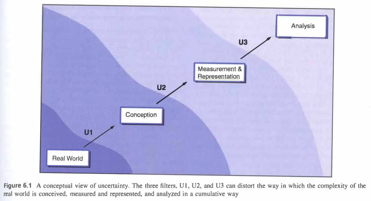
Image from Longley, et al. (2008).
Positionality and Construct Validity
In class we’ve talked about positionality, where different life experiences and social positions shape perceptions and reality, even in “objective” sciences. To me that seems like an important part of uncertainties in conception of geographic phenomena: where even the base understandings of truths and place and politics can play a role in the questions that are asked, or not asked. How can researchers be better held accountable for understanding their positionality, and to design studies where the validity of their questions is checked?
Inaccuracy in Measurement and Representation
In the next step, measurement and representation, data management, spatial, or statistical decisions can all perpetuate inaccuracies. I think that especially when producing visual representation of data, it’s important to be clear about the limitations of such representations, whether that’s through simplification or fuzzy classification or abstraction. It can be easy to misrepresent data or even mislead viewers through the unintentional (or intentional) choices made in cartography.
Representing Uncertainty
Accuracy will never be completely achieved, so representing those gaps is important. Geographers have a great responsibility to be responsible and thoughtful producers of knowledge, and to represent the inherent inaccuracies in their work. They must be transparent in their reporting of error, and any and all decisions to manage or reduce or represent data. I think that in the literature, descriptions and justifications for those steps would be a good way to relay those concerns and gaps to readers. In the spirit of open source, representing uncertainty and error throughout the research process is good practice anyway, and may push researchers to be accountable for misrepresentation of their work.
Reference
Longley, P. A., M. F. Goodchild, D. J. Maguire, and D. W. Rhind. 2008. Geographical information systems and science 2nd ed. Chichester: Wiley.